The American Southwest
Home | Parks | Trails | Plants | Canyons
Maps | Landscapes | Site Map | Whats New? |
More...
Follow americansouthwest.net on Facebook
×
General Pages
Home
Parks
Trails
Plants
Slot Canyons
Maps
Landscapes
Itineraries
Site Map
What's New?
More pages...

States
Arizona
California
Colorado
Idaho
Nevada
New Mexico
Oregon
Texas
Utah
Wyoming


ARIZONA
CALIFORNIA
COLORADO
IDAHO
NEVADA
NEW MEXICO
OREGON
TEXAS
UTAH
WYOMING
COLORADO
MAPS | PARKS | TRAILS | HOTELS

Map of Golden Gate Canyon State Park


Colorado > Golden Gate Canyon State Park > Map
Map of Golden Gate Canyon State Park


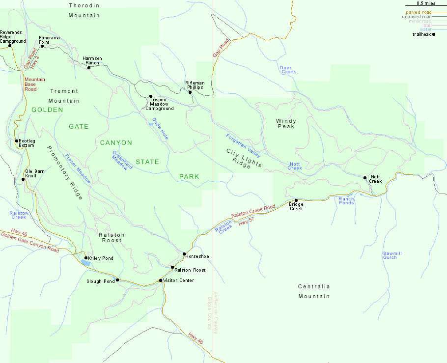
The north section of Golden Gate Canyon State Park is accessed by the unpaved Gap Road, starting one mile west along Hwy 119, while Hwy 46 and Hwy 57 give access to the southern portion. Mountain Base Road links the north and south routes.

Back to Top
Arizona | California | Colorado | Idaho | Nevada | New Mexico | Oregon | Texas | Utah | Wyoming | Slot Canyons | Travelogue | SOUTHWEST

All Contents © Copyright The American Southwest | Comments and Questions | Contribute | Affiliate Marketing Disclosure | Site Map