Highlights:
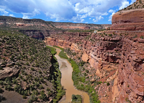
Forty mile section of the twisting, red rock canyon of the Dolores River, framed by dramatic cliffs of Wingate sandstone, and followed by Hwy 141, from the vicinity of Gateway in the north to the confluence with the San Miguel River in the south. Along the way are several viewpoints, including of the Hanging Flume, a suspended water chute built in the 1880s
Nearest city with chain hotels:
Grand Junction, 50 miles, from Gateway
Management:
BLM
Location:
38.680, -108.979 (Gateway)
Seasons:
All year, though affected by snow in the winter
Rating (1-5):
★★★★★

The Dolores River is a major tributary of the Colorado River, towards the east edge of the Colorado Plateau, and it forms two major canyon systems; one towards the upper (southern) end, a bendy and rather inaccessible stretch where the river flows through a series of tight, incised meanders, the other either side of the little settlement of Gateway, along Hwy 141.
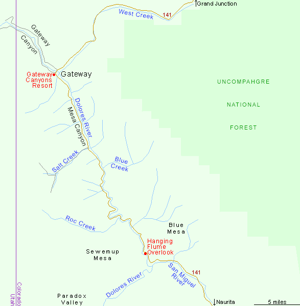
This area is known as the Gateway Canyons, a collective term for two separate sections - Gateway Canyon itself is to the north of town, about ten miles in length, while to the south is the longer and more scenic Mesa Canyon, which extends for 30 miles, all followed by the highway, until this turns away along a tributary, the San Miguel River. Further upstream, the Dolores remains enclosed for just a short distance, until it crosses the open spaces of Paradox Valley and enters high ground on the far side, into the upper canyon system.
This area is known as the Gateway Canyons, a collective term for two separate sections - Gateway Canyon itself is to the north of town, about ten miles in length, while to the south is the longer and more scenic Mesa Canyon, which extends for 30 miles, all followed by the highway, until this turns away along a tributary, the San Miguel River. Further upstream, the Dolores remains enclosed for just a short distance, until it crosses the open spaces of Paradox Valley and enters high ground on the far side, into the upper canyon system.
Gateway Canyons Table of Contents
- Map of the Gateway Canyons
- Photographs
- Introduction
- The scenic drive from Gateway
- Nearby places
- Similar places
Map of the Gateway Canyons
Photographs
13 views of the Gateway Canyons.
Introduction
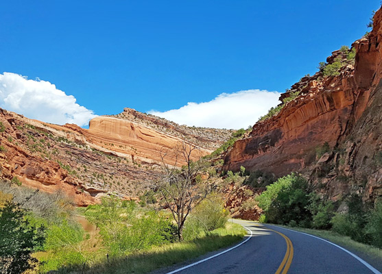
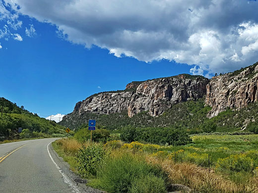
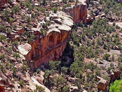
The drive from/to Gateway along Mesa Canyon is one of the best short scenic routes in the state. The road is at times right next to the river, in other places some distance above, on benches, and for most of the way it runs beneath towering red cliffs of Wingate sandstone, transitioning towards the southern end to lighter-colored strata from the Kayenta and Morrison formations. The river hereabouts is a popular rafting destination, with several challenging sets of rapids, while the whole area is rich in mining history, for gold and uranium. Also along the way are a few trailheads, and various overlooks, the most notable of the Hanging Flume, a suspended water chute, six miles long, that was built in the 1880s, taking water to a nearby gold mining operation.
Scenic Drive from Gateway
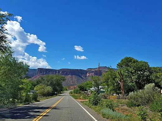
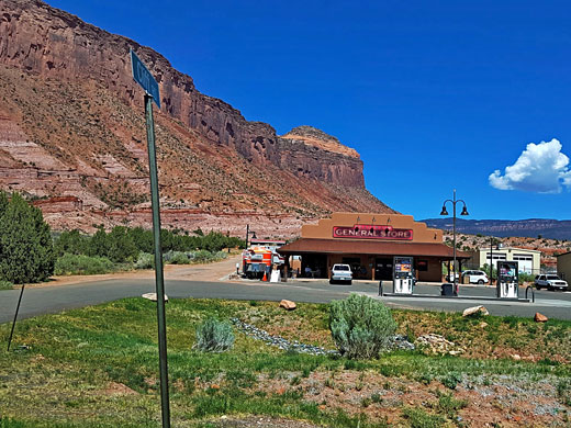
Hwy 141 approaches Gateway from the northeast, from Grand Junction. Gateway is a small community, with a post office, a few shops and one major business, the Gateway Canyons Resort, occupying a large site on the west side of the river. From here an unpaved track heads north along Gateway Canyon, crossing into Utah after 8 miles. The canyon here is wide and not as spectacular as that to the south, into which the road enters just beyond the resort, initially on the west side of the river. The valley sides at this point are sloping, formed of crumbling layers of the Moenkopi Formation, with the Wingate cliffs quite high above. To the south the canyon gradually becomes shallower, but also narrower, as the road comes closer to the cliffs. Various tributaries join, including Larsen Canyon, Bull Canyon and Blue Creek to the east, Cave Canyon, North Cottonwood Canyon and Salt Creek Canyon to the west, this latter the largest, and the only one with a road running through. At Roc Creek, another major tributary, the highway crosses to the east side of the river, and eventually rises above the Wingate, the river now enclosed by light brown cliffs of the Kayenta Formation, and here is the Hanging Flume, or rather, one short section of it - a wooden structure secured to a sheer cliff face about half way between river and rim, viewable from a roadside overlook. Just upstream, on the opposite side of the canyon, is a seasonal waterfall, beneath an arch. The overlook is one mile from the San Miguel River confluence, where the road leaves the Dolores River, now heading eastwards, to Naurita and then Telluride.
Gateway Canyons - Nearby Places
- Colorado National Monument (55 miles) - sheer walled red-rock canyons
- Telluride (100 miles) - famous old mining town in the San Juan Mountains
Gateway Canyons - Similar Places
- Burr Trail, Utah - backcountry road through canyons and red rock scenery
- Potash Road, Utah - road through the deepening canyon of the Colorado River west of Moab
All Contents © Copyright The American Southwest | Comments and Questions | Contribute | Affiliate Marketing Disclosure | Site Map