Photographs of the Mount Dana Trail, Yosemite National Park
California > Yosemite National Park > Tuolumne Meadows > Hiking > Mount Dana > Photographs
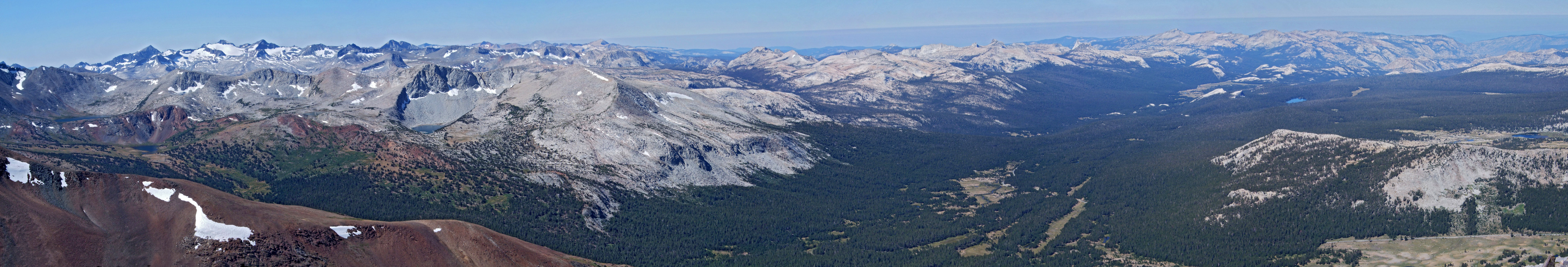
This photograph shows one quarter of the view from the summit of Mount Dana, between south and west, including the Kuna Crest, the Cathedral Range, Dana Meadows and Tuolumne Meadows. The areas of water, from left to right, are Lake Helen, Spillway Lake, Bingaman Lake, Kuna Lake, Dog Lake and Lower Gaylor Lake

Keywords: Yosemite National Park, the Mount Dana Trail, California, panoramas, Sierra Nevada, viewpoints, mountains, forest, granite
All Contents © Copyright The American Southwest | Comments and Questions | Contribute | Affiliate Marketing Disclosure | Site Map