Bear Hill and Soldiers Trails, Sequoia National Park
California > Sequoia National Park > Hiking > Bear Hill and Soldiers Trails


Bear Hill and Soldiers Trails
Relatively little-used loop in the Giant Forest, leading, half way, to the spectacular granite viewpoint of Moro Rock. The Bear Hill Trail climbs to a summit then winds across west-facing slopes, while the Soldiers Trail also rises, over a ridge, and though a somewhat more overgrown section of the forest
Length: 5.2 miles (loop)
Elevation change: 400 feet
Difficulty: Moderate
Type: Loop
Usage: Medium
Season: Spring, summer, fall
Trailhead: Giant Forest Village
Rating (1-5): ★★★★★
Elevation change: 400 feet
Difficulty: Moderate
Type: Loop
Usage: Medium
Season: Spring, summer, fall
Trailhead: Giant Forest Village
Rating (1-5): ★★★★★


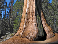
A paved road winds through the southern portion of the Giant Forest in Sequoia National Park, to Crescent Meadow, the largest patch of grassland hereabouts, and it also accesses two other well-known landmarks, the exposed granite dome of Moro Rock, and Tunnel Log, where the road passes right through the trunk of a huge fallen sequoia.
Because of the proximity to the road, trails in this region are rather less used than those in areas of the forest to the north, and so they offer a more tranquil experience of the ancient trees. Intersecting paths offer the scope for loop hikes, and perhaps the best is a 5.2 mile circuit incorporating the Bear Hill and Soldiers trails, plus the far end of the Moro Rock Trail. The Bear Hill route climbs a minor summit then winds across relatively open, west-facing slopes, linking with the path to Moro Rock, while the Soldiers Trail traverses more sheltered woodland, moister and with more undergrowth, also climbing over a high point and returning to the start, which is at Giant Forest Museum, along the Generals Highway.
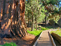
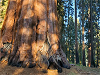
There are plenty of large sequoia all along the loop, and it offers varied views, both close up, of the forest, and long-distance, over the Sierra Nevada.
Giant Forest area map.
49 views along the Bear Hill and Soldiers trails.
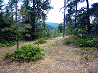
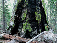
Parking for the Bear Hill-Soldiers loop is in the main lot at Giant Forest Village, on the west side of the highway, and just opposite the start of Crescent Meadows Road. The hike begins along this road a short distance, then turns left, along a path signed Bear Hill 0.4 miles, Hazelwood Trail 1 mile. The path climbs a slope, past a selection of sequoia, some fallen, and burnt in one location, before cutting back through more open woods to a high point (Bear Hill), the trees now only pines. Turning right at a junction (signed Moro Rock 1.7 miles), the path is straight for a while then traverses the hillside while staying fairly level, past a large burnt sequoia and then a named tree, Brigadier General Charles Young, near several other old-growth specimens.
The Bear Hill Trail descends through a ferny basin, similar in appearance to the coastal redwood forests, then crests a small ridge and drops down to the road, just before it splits into two, the routes to Crescent Meadow and Moro Rock. The path continues on the far side of the road, signed Moro Rock 0.4 miles; it passes a tiny stream and crosses the road again, very close to the edge of the forest and the big drop-off beyond, the views now extending a long way, down to the lowlands at the edge of the Central Valley. The path parallels the road, to the parking area for Moro Rock, the summit of which is reached by a 0.2 mile trail, rising 270 feet, and it has spectacular views over a large area of mountains, including along the deep canyon of the Middle Fork Kaweah River.
The return route is back along the approach path a short distance to a junction, turning right, signed Soldiers Trail. A 0.1 mile spur leads to the Roosevelt Tree, and soon after is another intersection; the right path leads down to Moro Rock Road, passing a particularly fine group of sequoia. Across the road are more big trees, in a sunnier section of the forest, after which the path follows a valley and crosses Crescent Meadow Road just west of Tunnel Log. A sign gives the distance back to Giant Forest Museum as 1.6 miles. The path follows close to the edge of a marshy meadow and continues into a moist basin, filled with many young trees and lots of undergrowth, especially colorful in the fall. It climbs, the surroundings now more open, and dry, passes over a ridge, and descends through two more junctions (right then left) and past a third, with the Hazelwood Trail. Keeping left, the path, now the Alta Trail, levels out, curves to the west and is soon running close to the Generals Highway its surface paved, back towards the Giant Forest parking lot.

Because of the proximity to the road, trails in this region are rather less used than those in areas of the forest to the north, and so they offer a more tranquil experience of the ancient trees. Intersecting paths offer the scope for loop hikes, and perhaps the best is a 5.2 mile circuit incorporating the Bear Hill and Soldiers trails, plus the far end of the Moro Rock Trail. The Bear Hill route climbs a minor summit then winds across relatively open, west-facing slopes, linking with the path to Moro Rock, while the Soldiers Trail traverses more sheltered woodland, moister and with more undergrowth, also climbing over a high point and returning to the start, which is at Giant Forest Museum, along the Generals Highway.
There are plenty of large sequoia all along the loop, and it offers varied views, both close up, of the forest, and long-distance, over the Sierra Nevada.
Location
Giant Forest area map.

Photographs
49 views along the Bear Hill and Soldiers trails.
Bear Hill Trail
Parking for the Bear Hill-Soldiers loop is in the main lot at Giant Forest Village, on the west side of the highway, and just opposite the start of Crescent Meadows Road. The hike begins along this road a short distance, then turns left, along a path signed Bear Hill 0.4 miles, Hazelwood Trail 1 mile. The path climbs a slope, past a selection of sequoia, some fallen, and burnt in one location, before cutting back through more open woods to a high point (Bear Hill), the trees now only pines. Turning right at a junction (signed Moro Rock 1.7 miles), the path is straight for a while then traverses the hillside while staying fairly level, past a large burnt sequoia and then a named tree, Brigadier General Charles Young, near several other old-growth specimens.


Moro Rock
The Bear Hill Trail descends through a ferny basin, similar in appearance to the coastal redwood forests, then crests a small ridge and drops down to the road, just before it splits into two, the routes to Crescent Meadow and Moro Rock. The path continues on the far side of the road, signed Moro Rock 0.4 miles; it passes a tiny stream and crosses the road again, very close to the edge of the forest and the big drop-off beyond, the views now extending a long way, down to the lowlands at the edge of the Central Valley. The path parallels the road, to the parking area for Moro Rock, the summit of which is reached by a 0.2 mile trail, rising 270 feet, and it has spectacular views over a large area of mountains, including along the deep canyon of the Middle Fork Kaweah River.


Soldiers Trail
The return route is back along the approach path a short distance to a junction, turning right, signed Soldiers Trail. A 0.1 mile spur leads to the Roosevelt Tree, and soon after is another intersection; the right path leads down to Moro Rock Road, passing a particularly fine group of sequoia. Across the road are more big trees, in a sunnier section of the forest, after which the path follows a valley and crosses Crescent Meadow Road just west of Tunnel Log. A sign gives the distance back to Giant Forest Museum as 1.6 miles. The path follows close to the edge of a marshy meadow and continues into a moist basin, filled with many young trees and lots of undergrowth, especially colorful in the fall. It climbs, the surroundings now more open, and dry, passes over a ridge, and descends through two more junctions (right then left) and past a third, with the Hazelwood Trail. Keeping left, the path, now the Alta Trail, levels out, curves to the west and is soon running close to the Generals Highway its surface paved, back towards the Giant Forest parking lot.


Topographic Map of the Bear Hill-Soldiers Loop