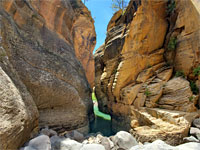


Kelly Canyon
Wooded ravine with seasonal pools but no significant obstacles, meeting the larger drainage of Pumphouse Wash; downstream, this deepens steadily, passing larger pools and an unusual arch. A loop can be made by climbing the east side of Pumphouse Wash and returning via forest tracks
Length: 2.6 miles to the confluence, 4.5 miles to the arch, 7.6 miles for the loop
Elevation change: 400 feet to the confluence, 650 feet to the arch
Difficulty: Moderate
Type: One way or loop, off-trail
Usage: Low
Season: Spring, summer and fall; affected by snow in the winter
Trailhead: Kelly Canyon Road, I-17 exit 331
Rating (1-5): ★★★★★
Elevation change: 400 feet to the confluence, 650 feet to the arch
Difficulty: Moderate
Type: One way or loop, off-trail
Usage: Low
Season: Spring, summer and fall; affected by snow in the winter
Trailhead: Kelly Canyon Road, I-17 exit 331
Rating (1-5): ★★★★★


13 miles north of Sedona, Kelly Canyon is one of two major tributaries of Pumphouse Wash, which 4 miles downstream merges with Sterling Canyon to form Oak Creek Canyon. The other tributary, James Canyon, contains deep pools, drop-offs and other obstacles, but there are no such difficulties in Kelly, and it offers a pleasant walk down a wooded gorge, past a few minor pools, patches of slickrock and small cliffs, to the Pumphouse confluence, a distance of 2.6 miles.
The hike may be extended by walking downstream along Pumphouse Wash (upstream the drainage is generally shallow and not so interesting) - this deepens steadily, passing one large, basalt-lined pool, to an enclosed area with more pools, sheer cliffs and an unusual, elephant-like arch, this just past the junction with James Canyon, reached after a total walk of 4.5 miles.
Pumphouse can be followed further, down the photogenic lower section or, as an alternative, a loop hike can be made by retreating upstream a short distance, climbing the canyon sides then returning to the Kelly Canyon trailhead via forest tracks, to make a round-trip hike of 7.6 miles.
The upper end of Kelly Canyon is approached from the south via gravel tracks through the ponderosa pine forest, starting from I-17 exit 331. A suitable parking place is 0.8 miles from the interstate on a minor high point, near Kelly Seep. All this land is part of the Coconino National Forest and is perfect for free primitive camping, crossed by good-quality tracks and with plenty of clearings in which to park.
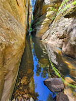
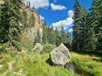
From the high point, a short walk north, down a slope, reaches the canyon floor, joining it near a fork in the canyon. Downstream, walking is easy since the undergrowth is light. A straight passage leads to a nice pool (seasonal) below a colorful protruding rock. A faint path is evident in some places. Another reflective pool below a cliff is followed by an alcove and then a wider section and the junction with a larger tributary on the north side, one followed by a recognised path, from Kelly Pocket. Ahead are some patches of grooved slickrock and more pools, before the canyon bends to the left, narrows and the floor becomes mostly boulders, leading to a bigger patch of slickrock at the confluence with Pumphouse Wash.
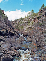
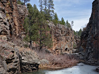
Just upstream are some photogenic cliffs, the sandstone in shades of red, pink and brown, while downstream the canyon remains wide and not so overgrown, and a path follows along the west edge, through patches of trees. A colorful alcove, also on the west side, contains at least one faded petroglyph, a spiral. The path seems to fade away and the drainage becomes filled with boulders, which transition to a rocky, basalt passage as the ravine deepens more noticeably, up to a drop off at the brink of a big pool of greenish water, passed on the left. Taller, vertical cliffs come into view ahead. James Canyon joins from the left, its lower end very overgrown, making for difficult walking. Pumphouse then passes a detached sandstone monolith and then the unusual arch, followed by more pools beneath sheer cliffs; the suggested turnaround point.
The quickest way back to the trailhead from here is to ascend the slopes on the east side of the gorge, just north of the intersection with James Canyon, soon reaching the end of a forest track which is followed for 1.8 miles, back to the start point - a mostly level route through open woodland just a few gentle rises. The surroundings are quiet and tranquil.

The hike may be extended by walking downstream along Pumphouse Wash (upstream the drainage is generally shallow and not so interesting) - this deepens steadily, passing one large, basalt-lined pool, to an enclosed area with more pools, sheer cliffs and an unusual, elephant-like arch, this just past the junction with James Canyon, reached after a total walk of 4.5 miles.
Pumphouse can be followed further, down the photogenic lower section or, as an alternative, a loop hike can be made by retreating upstream a short distance, climbing the canyon sides then returning to the Kelly Canyon trailhead via forest tracks, to make a round-trip hike of 7.6 miles.


Trailhead
The upper end of Kelly Canyon is approached from the south via gravel tracks through the ponderosa pine forest, starting from I-17 exit 331. A suitable parking place is 0.8 miles from the interstate on a minor high point, near Kelly Seep. All this land is part of the Coconino National Forest and is perfect for free primitive camping, crossed by good-quality tracks and with plenty of clearings in which to park.

Kelly Canyon
From the high point, a short walk north, down a slope, reaches the canyon floor, joining it near a fork in the canyon. Downstream, walking is easy since the undergrowth is light. A straight passage leads to a nice pool (seasonal) below a colorful protruding rock. A faint path is evident in some places. Another reflective pool below a cliff is followed by an alcove and then a wider section and the junction with a larger tributary on the north side, one followed by a recognised path, from Kelly Pocket. Ahead are some patches of grooved slickrock and more pools, before the canyon bends to the left, narrows and the floor becomes mostly boulders, leading to a bigger patch of slickrock at the confluence with Pumphouse Wash.


Pumphouse Wash
Just upstream are some photogenic cliffs, the sandstone in shades of red, pink and brown, while downstream the canyon remains wide and not so overgrown, and a path follows along the west edge, through patches of trees. A colorful alcove, also on the west side, contains at least one faded petroglyph, a spiral. The path seems to fade away and the drainage becomes filled with boulders, which transition to a rocky, basalt passage as the ravine deepens more noticeably, up to a drop off at the brink of a big pool of greenish water, passed on the left. Taller, vertical cliffs come into view ahead. James Canyon joins from the left, its lower end very overgrown, making for difficult walking. Pumphouse then passes a detached sandstone monolith and then the unusual arch, followed by more pools beneath sheer cliffs; the suggested turnaround point.


Return Route
The quickest way back to the trailhead from here is to ascend the slopes on the east side of the gorge, just north of the intersection with James Canyon, soon reaching the end of a forest track which is followed for 1.8 miles, back to the start point - a mostly level route through open woodland just a few gentle rises. The surroundings are quiet and tranquil.


Topographic Map of Kelly Canyon