Home
|
Parks
|
Trails
|
Plants
|
Canyons
Maps
|
Landscapes
|
Site Map
|
Whats New?
|
More...
×
General Pages
Home
Parks
Trails
Plants
Slot Canyons
Maps
Landscapes
Itineraries
Site Map
What's New?
More pages...
States
Arizona
California
Colorado
Idaho
Nevada
New Mexico
Oregon
Texas
Utah
Wyoming
MENU
ARIZONA
CALIFORNIA
COLORADO
IDAHO
NEVADA
NEW MEXICO
OREGON
TEXAS
UTAH
WYOMING
UTAH
MAPS
|
PARKS
|
TRAILS
|
HOTELS
All Utah Locations...
NPS
Arches
Bryce Canyon
Canyonlands
Capitol Reef
Cedar Breaks
Dinosaur
Glen Canyon
Golden Spike
Hovenweep
Natural Bridges
Timpanogos Cave
Zion
OTHER PLACES
Anasazi SP
Antelope Island SP
Bear Lake
Bears Ears NM
Buckskin Hollow
Canyon Rims RA
Cedar Mesa/Grand Gulch
Cisco
Coral Pink Sand Dunes SP
Dark Canyon
Dead Horse Point SP
Dixie National Forest
Escalante Petrified Forest SP
Factory Butte
Fantasy Canyon
Fisher Towers
Flaming Gorge NRA
Goblin Valley SP
Goosenecks SP
Grafton
Grand Staircase-Escalante NM
Gunlock SP
Henry Mountains
Kodachrome Basin SP
La Sal Mountains
Little Egypt
Little Sahara RA
McConkie Ranch Petroglyphs
Mexican Hat
Moab
Montezuma Canyon
Monument Valley
Mount Timpanogos
Nebo Loop
Nine Mile Canyon
Paria Rimrocks
Parowan Gap
Potash Road
Red Canyon
Red Cliffs RA
Salt Lake Desert
San Rafael Swell
Sand Hollow SP
Santa Clara River Reserve
Sego Canyon
Snow Canyon SP
Uinta Mountains
Valley of the Gods
Wasatch Mountain SP
Yant Flat Cliffs
Utah site map
Photographs of Goblin Valley State Park
Utah
>
Goblin Valley State Park
> Photographs
Blue sky and clouds
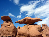
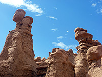
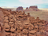
Hoodoos by the entrance
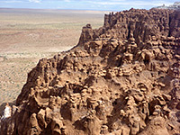
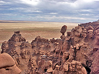
Edge of the cliffs
Hoodoos on a ridge
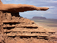
Protruding rock
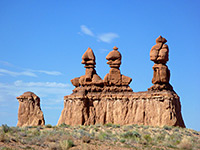
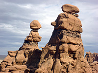
Tall hoodoos
Goblins in the valley
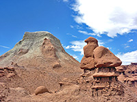
Layered rocks
Pinnacles
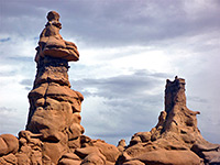
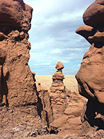
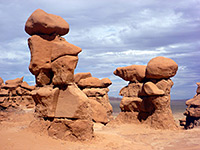
Pair of goblins
Narrow opening
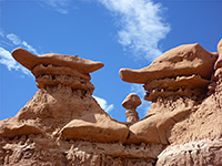
Flat-topped goblins
Side ravine
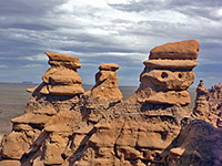
Red goblins
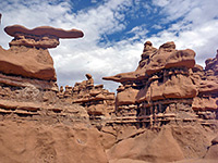
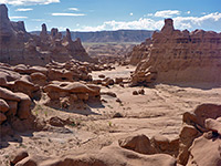
Hundreds of hoodoos
Hoodoos to the east
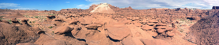
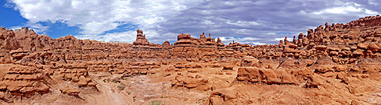
Panorama of the valley
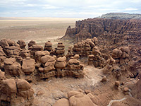
San Rafael Desert
East edge of the valley
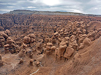
Thousands of hoodoos
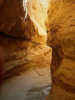
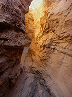
Slot canyon
Enclosed channel
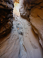
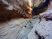
Shallow narrows
Straight passageway
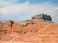
Badlands
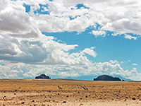
Pronghorn antelope
Related Photographs:
Badlands
-
Hoodoos
-
Red rocks
-
San Rafael Swell
Back to Top
All Contents © Copyright The American Southwest
|
Comments and Questions
|
Contribute
|
Affiliate Marketing Disclosure
|
Site Map