Bullfrog Marina, Glen Canyon National Recreation Area
Utah > Glen Canyon National Recreation Area > Bullfrog Marina
Highlights:
Marina, campground and other facilities serving the northeast side of Lake Powell, reached by scenic highway 276 past the Henry Mountains. Plenty of shoreline access points, and a dispersed primitive camping area
Location:
37.518, -110.743 (ferry ramp)

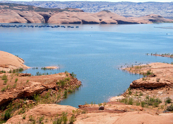
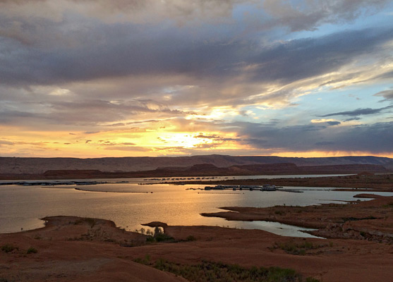
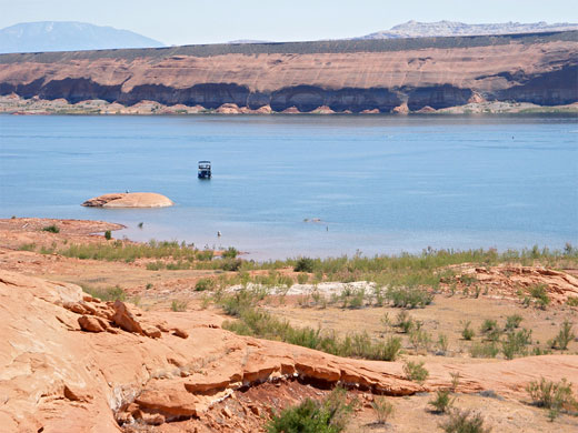
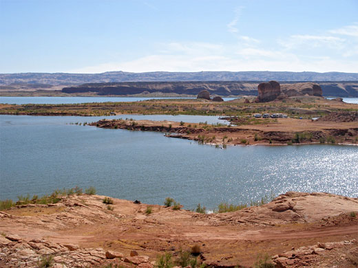
Ninety six river miles upstream from the main Lake Powell visitor hub at Page/Wahweap, the remote but relatively busy marina at Bullfrog also has a full range of facilities, and an equally scenic setting, at the edge of the calm blue waters of Bullfrog Bay. Boating and fishing are the main activities, but several miles of the shoreline are accessible for hiking, swimming or primitive camping, whilst the surrounding land offers much to see, with the Henry Mountains, Little Rockies and the southern end of the Waterpocket Fold all within 30 miles.
Although the highway ends at the lakeshore, through travel is possible via the ferry to Halls Crossing on the south side; this operates all year, with departures every two hours during the summer months.
Although the highway ends at the lakeshore, through travel is possible via the ferry to Halls Crossing on the south side; this operates all year, with departures every two hours during the summer months.
Bullfrog Table of Contents
Roads to Bullfrog
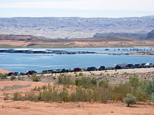
Two roads lead to the marina; the mostly unpaved Notom-Bullfrog Road that starts along UT 24 next to the east entrance of Capitol Reef National Park, or the usual route, state highway 276 which forks off UT 95, 27 miles south of Hanksville. This passes much spectacular scenery along its 40 miles, starting by crossing Trachyte Creek and some of its slot canyon tributaries including Maidenwater and Swett Creeks, then climbing into the foothills of the Little Rockies, a small but colorful range formed by igneous peaks surrounded by a ring of upturned, twisted sandstone. The road also has good views over a large area of red ledges and mesas stretching west towards the Waterpocket Fold, and of the flatter, more open land to the south (Cane Springs Desert). The last 15 miles cross this open, sandy expanse, as the lake comes gradually into view. There is just one settlement en route, at Ticaboo, a welcoming place with a cafe, shop, lodge and gas station; soon after this the road passes several boat storage facilities, the junction with the road to Notom, and then the NPS entrance station, where the fee of $30 per vehicle (2020) is collected.
Facilities at Bullfrog Marina
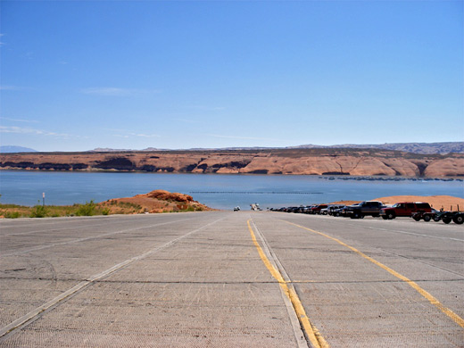
Highway 276 leads right to the lake, ending in a wide launch ramp that is usable for water levels down to 3,580 feet, 110 feet below the maximum surface elevation. The last 2 miles of the road passes various turn-offs, firstly to a primitive camping area along Stanton Canyon - a 2 mile track descends a shallow ravine and splits into many lesser tracks that reach beaches right by the water's edge, all with views of distant red buttes and cliffs, though the immediate surroundings are less scenic sandy hills. A fee of $6 per site per night is charged; the nearest free camping places are along side roads off UT 276, such as 3 miles before the park boundary beside Hansen Creek, while for those needing more facilities, there is a proper campground with hookups along the main road close to the lake. Other side roads lead to the ferry terminus, various carparks, the marina, and Defiance House Lodge. Services at Bullfrog include a gift shop, general store, boat rentals, clinic, picnic area, bookshop, post office and visitor center that has exhibits about local geology, history and wildlife.
Hiking near Bullfrog
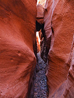
Bullfrog Bay Canyon
★★★★★
★★★★★
0.5 miles, 50 feet
Short, shallow, pebble-floored canyon leading to Bullfrog Bay on the north side of Lake Powell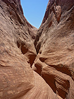
East Sevenmile Canyon
★★★★★
★★★★★
3 miles, 500 feet (round trip)
Remote ravine leading to a fine view of Lake Powell; two forks, both with short slots, dropping off steeply down to the lake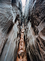
Smith Fork
★★★★★
★★★★★
7.5 miles, 500 feet
Good narrows through Navajo sandstone, in a secluded, rarely visited drainage leading to Lake PowellAll Contents © Copyright The American Southwest | Comments and Questions | Contribute | Affiliate Marketing Disclosure | Site Map