Highlights:
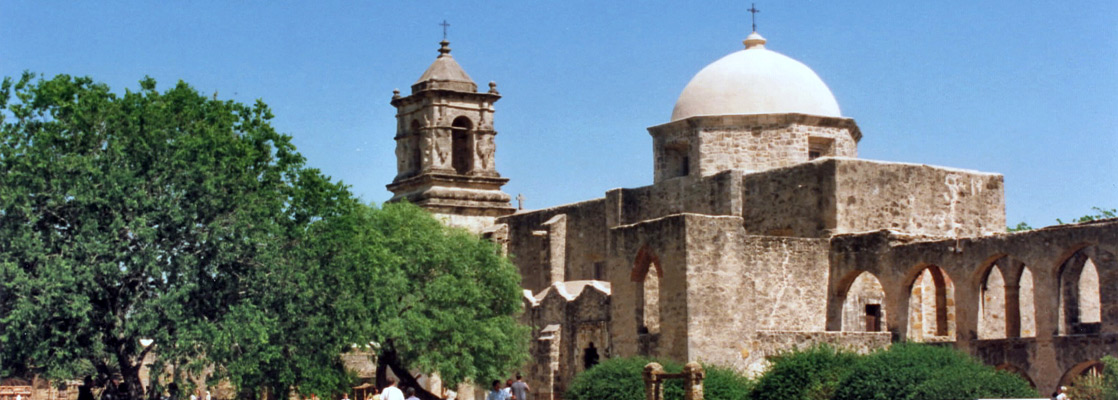
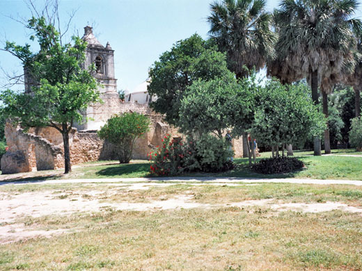
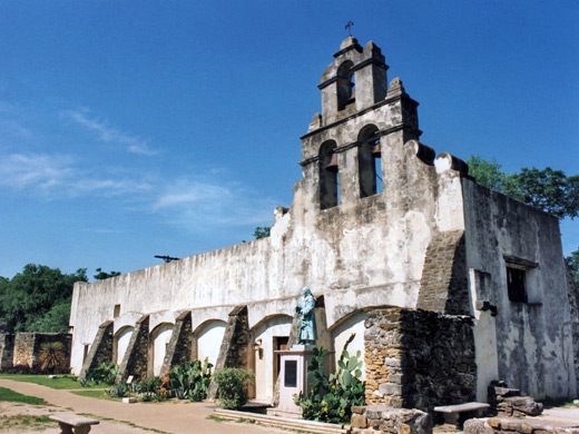
Five ornate, well preserved Spanish churches dating from 1718, built in peaceful, semi-rural land close to the San Antonio River, and all still used for services. Park includes pathways, cultivated fields, riverside land and various other historic structures
Nearby town:
Management:
Location:
Seasons:
All year
Rating (1-5):
★★★★★
Weather:


San Antonio Missions NHS is part of the West and Central Texas itinerary
Featured Hotel
Holiday Inn Express San Antonio SE
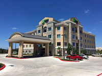 Four storey hotel in southeast San Antonio, part of the City Base development, 4 miles from Mission San Jose. Free hot breakfast and an outdoor pool
Check Rates
Settlement in the San Antonio area dates from the early eighteenth century when explorers crossed the Rio Grande and began travelling though the lands north of Mexico, with the aim of extending the new Spanish territories. Besides the acquisition of new land, these pioneers also sought to spread the Catholic faith - new villages were based around a large church with other buildings for storage and living quarters, which together with cultivated areas for crops and animals were enclosed in a high protective wall, to ward off attacks from unfriendly groups of roving Apache and Comanche Indians.
The whole compound was termed a mission, and several dozen were built across south Texas, always near a river; as well as the San Antonio, they were constructed along the Rio Grande and Nueces, and further east along the Neches and Angelina. After the new territory was secured, the missions became important links in the supply route to lands in the east that were being threatened by French insurgents from Louisiana.
The whole compound was termed a mission, and several dozen were built across south Texas, always near a river; as well as the San Antonio, they were constructed along the Rio Grande and Nueces, and further east along the Neches and Angelina. After the new territory was secured, the missions became important links in the supply route to lands in the east that were being threatened by French insurgents from Louisiana.
San Antonio Missions Table of Contents
- Maps, from the NPS
- Photographs
- The missions
- Surroundings of the missions
- Tours of the missions
- Nearby places
- Similar places
Maps
PDF format maps of San Antonio Missions National Historical Park, from the National Park Service:
Detailed park map (288 kb)
Texas Missions map (76 kb): Spanish Missions In Texas, 1659-1795.
Photographs
11 views of the San Antonio Missions.
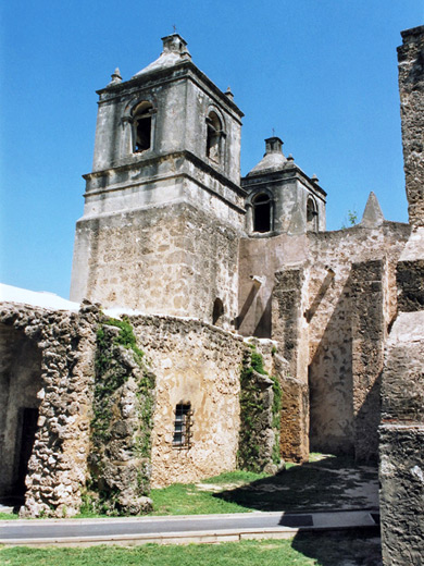
The Missions
Descriptions of the five missions
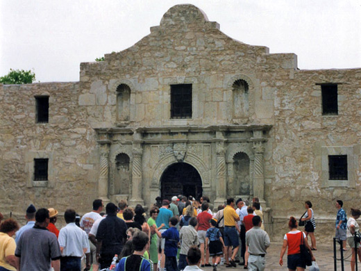
In 1718 Mission San Antonio de Valero was established along the San Antonio River; it was renamed The Alamo at the start of the next century and received enduring fame in 1836 at the culmination of a period of fierce Mexican attacks during the Texan War of Independence, when around 180 defenders, made up of settlers and native Texans, held out for 13 days against up to 5,000 enemy soldiers before finally being defeated. A second mission, San José, was founded nearby in 1720, and three unsuccessful communities from the Neches River in the east were transferred 10 years later. A fort, a village and an irrigation system with dam and aqueduct were added soon after, and the communities flourished, gradually becoming augmented by other development and forming the city of San Antonio.
Surroundings of the Missions
The five San Antonio missions survive intact and the southernmost four are protected as a National Historical Park, which incorporates various sites and tracts of land along the river connected by the Mission Trail, a 12 mile route along city streets that when complete will link The Alamo in the centre with Mission Espada, southernmost of the 5 churches. Outside the downtown area, the San Antonio River occasionally floods but usually has low water levels and is not particularly attractive. It is surrounded by a half mile ribbon of grass and woodland at either side; beyond, the suburbs of the city have extended most of the way south although not close enough to disturb the tranquil atmosphere of the missions, four of which are still used for regular church services.
Tours of the Missions
San Antonio Missions - Nearby Places
- Palmetto State Park (60 miles) - swampy environment with exotic plants and wildlife
- Pedernales Falls State Park (72 miles) - wide waterfall along a clear river
San Antonio Missions - Similar Places
- California Missions - 21 churches in the south of the state
- Tumacacori National Historical Park - 18th century Spanish mission, near Nogales
All Contents © Copyright The American Southwest | Comments and Questions | Contribute | Affiliate Marketing Disclosure | Site Map