Home
|
Parks
|
Trails
|
Plants
|
Canyons
Maps
|
Landscapes
|
Site Map
|
Whats New?
|
More...
×
General Pages
Home
Parks
Trails
Plants
Slot Canyons
Maps
Landscapes
Itineraries
Site Map
What's New?
More pages...
States
Arizona
California
Colorado
Idaho
Nevada
New Mexico
Oregon
Texas
Utah
Wyoming
MENU
ARIZONA
CALIFORNIA
COLORADO
IDAHO
NEVADA
NEW MEXICO
OREGON
TEXAS
UTAH
WYOMING
TEXAS
MAPS
|
PARKS
|
TRAILS
|
HOTELS
All Texas Locations...
NPS
Alibates Flint Quarries
Amistad
Big Bend
Fort Davis
Guadalupe Mountains
Lake Meredith
Padre Island
San Antonio Missions
OTHER PLACES
Big Bend Ranch State Park
Black Gap WMA
Caprock Canyons State Park
Davis Mountains State Park
Dinosaur Valley State Park
Enchanted Rock SNA
Fort Leaton SHS
Franklin Mountains State Park
Hueco Tanks State Park
Langtry
Lost Maples SNA
Monahans Sandhills State Park
Odessa Meteor Crater
Palmetto State Park
Palo Duro Canyon State Park
Pedernales Falls State Park
Texas site map
Photographs of Lost Maples State Natural Area
Texas
>
Lost Maples State Natural Area
> Photographs
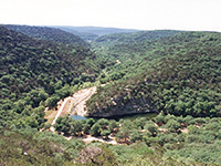
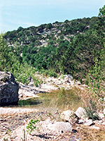
View down Can Creek
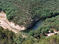
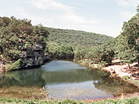
Lake beside the East Trail
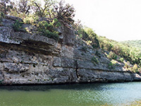
Above Can Creek
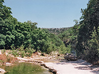
Can Creek
View along the Maple Trail
Lake along the East Trail
Side road north of the park
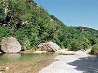
Two large boulders
Related Photographs:
RVs
-
Texas lakes
-
Texas rivers
Back to Top
All Contents © Copyright The American Southwest
|
Comments and Questions
|
Contribute
|
Affiliate Marketing Disclosure
|
Site Map