East of Caprock Canyons State Park, the Rolling Plains stretch for over 100 miles, characterised by patches of flat, agriculturalized land between larger areas of rough prairie. Two branched rivers meander across this part of the plains, each flowing within a corridor of rugged badlands, and the park sits on a little ridge separating the two watersheds. The larger of the two is the Prairie Dog Town Fork of the Red River, running 12 miles north of the caprock canyons, and which further upstream passes through Palo Duro Canyon State Park - larger in area and receiving many more visitors though with comparable scenery. The distance by road between the two state parks is 95 miles, via I-27 and Texas route 86.
The other nearby drainage basin is that of the Pease River, southeast of the caprock canyons, and this has two areas for public use. Closest (by road) is the 28,000 acre Matador Wildlife Management Area, a few miles north of Paducah in Cottle County; this contains a large area of low, wooded hills and washes, used for hunting, camping and wildlife study. 35 miles further east, Copper Breaks State Park on route 6 between Crowell and Quanah is an area of mesas and small cliffs, tinted green by copper deposits. The state park borders the Pease River and also has a tiny lake, several short trails, and plenty of campsites.
To the west of the Caprock Canyons, the landscape is rather different as here begin the flat, featureless High Plains. Highways 236 north of the park and 86 to the south climb the caprock escarpment and converge just outside Silverton, population only around 800 but still the largest town for some distance.
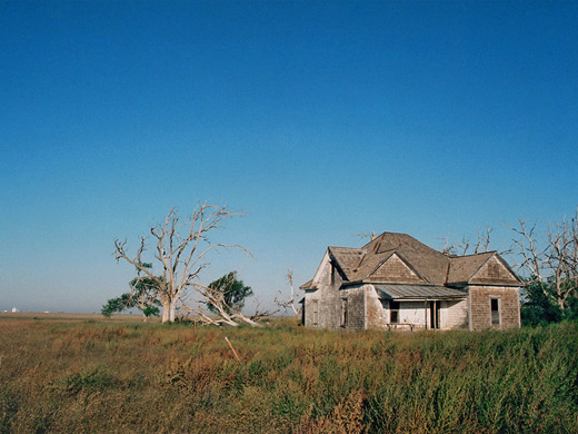
Once above the escarpment, for the first 10 miles or so the land is still not much developed, mostly grassy scrubland bearing an occasional tree or cactus, and used for cattle grazing, but further west it is farmed quite extensively. Every road passes the same scenery - endless, identical blocks of farmland, principally cotton, sorghum and wheat, and with only telegraph poles, grain silos and farms interrupting the perfectly flat horizon. State road 145 gives a good impression of the farming communities, as well as being the most direct route to Caprock Canyons State Park from New Mexico. The road doesn't bear much traffic and while there are no official camping places, overnight stops are possible at some of the abandoned houses that are found at frequent intervals.
The other nearby drainage basin is that of the Pease River, southeast of the caprock canyons, and this has two areas for public use. Closest (by road) is the 28,000 acre Matador Wildlife Management Area, a few miles north of Paducah in Cottle County; this contains a large area of low, wooded hills and washes, used for hunting, camping and wildlife study. 35 miles further east, Copper Breaks State Park on route 6 between Crowell and Quanah is an area of mesas and small cliffs, tinted green by copper deposits. The state park borders the Pease River and also has a tiny lake, several short trails, and plenty of campsites.
To the west of the Caprock Canyons, the landscape is rather different as here begin the flat, featureless High Plains. Highways 236 north of the park and 86 to the south climb the caprock escarpment and converge just outside Silverton, population only around 800 but still the largest town for some distance.
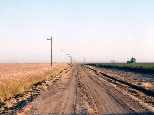
Once above the escarpment, for the first 10 miles or so the land is still not much developed, mostly grassy scrubland bearing an occasional tree or cactus, and used for cattle grazing, but further west it is farmed quite extensively. Every road passes the same scenery - endless, identical blocks of farmland, principally cotton, sorghum and wheat, and with only telegraph poles, grain silos and farms interrupting the perfectly flat horizon. State road 145 gives a good impression of the farming communities, as well as being the most direct route to Caprock Canyons State Park from New Mexico. The road doesn't bear much traffic and while there are no official camping places, overnight stops are possible at some of the abandoned houses that are found at frequent intervals.
All Contents © Copyright The American Southwest | Comments and Questions | Contribute | Affiliate Marketing Disclosure | Site Map