| 10.41 |
Passed underneath a big log jam, many meters above near the canyon roof. |
| 10.47 |
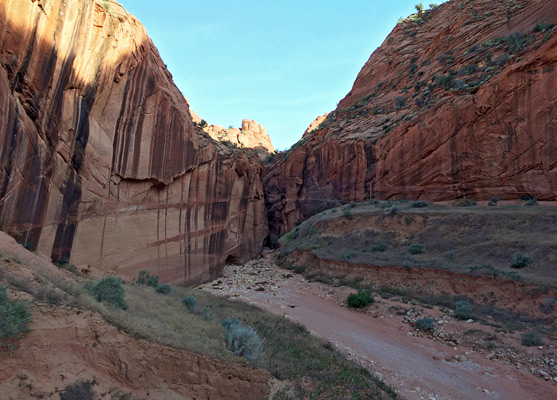
The cliffs open out; this is the beginning of the widest part of the canyon with many high sandbanks with grass, trees and wildflowers, and several possible campsites. |
| 11.03 |
End of the widest section, although the Gulch remains generally quite wide and sunny for a
little while longer. |
|
| 11.19 |
On the right (south) side there is a possible route to climb out of the canyon; I went about half-way but it seemed easy to ascend further to the desert above. |
| 11.25 |
A section with largish boulders. |
| 11.30 |
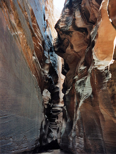
Became very narrow again. |
| 11.43 |
A short wide area. |
| 11.52 |
A second possible climb-out route, to the left (north) side up a diagonal gradient along the side of the canyon walls. |
| 11.57 |
A long log firmly wedged between two boulders; this would assist climbing at least part of the way up the cliffs to the right (south). |
| 11.59 |
The Gulch turns sharply to the right - this is one of several turns where the canyon seems to stop abruptly, and it is not until very close that the direction in which it continues can be seen. |
| 12.06 |
Another potential route to exit the canyon, on the north side. There is a short length of rope,
left by a previous climber, which helps to make an initial climb, and several possible ways to continue. |
| 12.10 |
A sharp left turn, with a deep, almost dried-up pool underneath that may present quite an obstacle in wet conditions. |
| 12.19 |
A long pool of sticky, stagnant mud, up to 2 feet deep, behind a recent-looking boulder pile that appeared not to have had water flowing over it yet. This is the start of a rather dark and gloomy section of the canyon, with extensive mud and several pools of cold water between narrow rocky passages. |
|
| 12.32 |
Another sharp left turn. |
| 12.37 |
A short wider section with trees and sand, and places to camp safely. |
| 12.41 |
A big tree stump, close to another pool, followed by more pools and a log wedged maybe 70 feet above. There are many such logs wedged at intervals between the canyon walls, but this was about the highest above the floor. |
|
| 12.45 |
A longish straight section, and then more boulders. There were several raucous crows nesting around here; their cries echoed rather eerily along the dimly-lit passages. |
| 12.50 |
The deepest pool - around 3 feet. There were 2 big logs soon after, jammed above the streamway, and
then another deep pool.. |
| 1.00 |
The canyon became quite dark, narrow and cave-like, with many more cold pools. Alternating warm and cool winds blew as the passage turned right and left, with only occasional glimpses of the sun. |
|
| 1.04 |
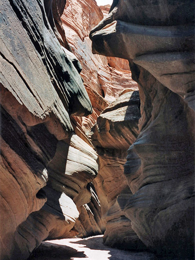
A big tree stump, stuck low down; after this was a drier stretch with particularly nice, photogenic curvy walls. |
| 1.12 |
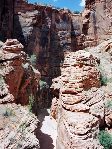
A wide section, with a climb-out route on the left (north), (temporarily) marked by a stone cairn. This is the exit point to the Middle Trail and was one of several parts of the cliffs in this region on both sides that seemed climbable. |
| 1.18 |
A second long straight passage, quite narrow. |
| 1.25 |
Plenty of big boulders; here the Gulch was generally wider. |
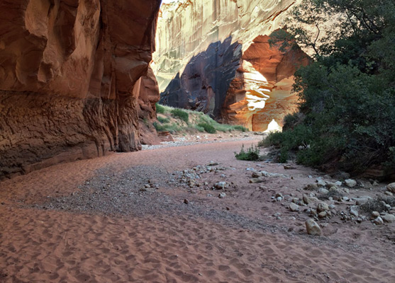
| 1.30 |
Green trees and bushes on the right, closely followed by an area with grassy sand banks as the canyon became temporarily V-shaped. |
| 1.39 |
A huge boulder wedged above the watercourse, when the canyon narrowed again |
| 1.52 |
A tree on the left marked the last possible chance for climbing out of the canyon before the confluence with the Paria River. |
| 1.56 |
A grassy area on the right - another possible camping place, followed by more big boulders. |
| 1.59 |
Lots of green trees at both sides - a pretty area. |
| 2.03 |
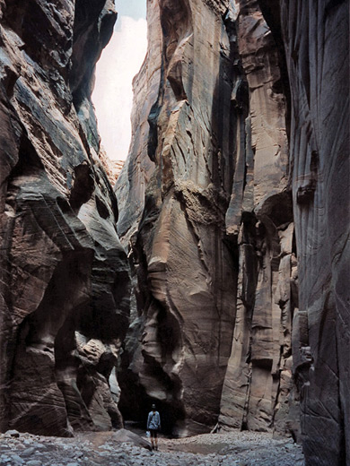
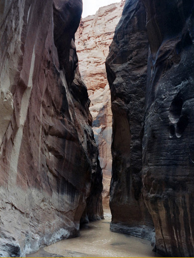
More boulders for a while, then another nice narrow section with colorful walls that rise up to 400 feet above the floor. |
| 2.20 |
A sharp left turn, as the canyon became darker and even narrower. |
| 2.25 |
The narrowest section - only 2 feet wide. |
| 2.30 |
A pile of large boulders, with a 20 foot drop downstream. The difficulty of this obstruction seems to change with each major flood; at this time it was quite easy to negotiate by climbing down a hole between wedged logs a few meters before the drop-off, under some of the boulders and through a depression that probably has water in wetter conditions to the flat canyon floor beyond. Here I rested for 15 minutes and continued alone. |
| 2.49 |
A large green tree, with a semi-detached tower of rock on the right (south) soon beyond. |
| 2.51 |
More trees, and a high sand bank. |
| 2.57 |
Water seeping from the walls began to form a very shallow stream which flows slowly along the floor. The clear (drinkable?) water is a pleasant contrast to the numerous muddy pools encountered previously. |
| 3.04 |
Large, extensive sandy banks with many trees and flat grassy areas high above the streambed - a popular location for camping. |
|
| 3.08 |
Finally reached the confluence with the Paria River, which was fast-flowing with light brown muddy water, up to 6 inches deep. There were some sandy areas but the river generally covered all of the canyon floor. |
| 3.18 |
Started the return journey. |
| 8.10 |
Reached the Wire Pass trailhead, just 20 minutes before darkness set in; a total walk of 27 miles in 10.5 hours. There is not much wildlife in the canyon; I saw only crows, swifts, bats and one lonely mouse in one of the dark, damp sections, but no sign of the rattlesnakes that are supposed to be present. There were 3 dead birds, including an eagle, and other scattered bones.
|