Home
|
Maps
|
Landscape Categories
|
National Parks
|
Hotels
|
Site Map
|
Whats New?
|
More...
TEXAS
Index
|
Introduction
|
Photographs
|
QTVR
|
Driving Distances
|
Map
|
Weather
|
Hotels
Texas - Site Map
Sites in Texas
NPS Units
Alibates Flint Quarries
Amistad
Big Bend
Guadalupe Mountains
Lake Meredith
Padre Island
San Antonio Missions
Other Places
Big Bend Ranch
Black Gap
Caprock Canyons
Dinosaur Valley
Enchanted Rock
Langtry
Lost Maples
Palmetto
Palo Duro Canyon
Pedernales Falls
Texas Site Map
Site Search
Photograph Search
Index
Introduction
Photographs
QTVR
Driving Distances
Map
Weather
Hotels
National Parks and National Monuments
State Parks and State Natural Areas
Alibates Flint Quarries National Monument
Photographs
Amistad National Recreation Area
Big Bend National Park
Chisos Mountains
Lost Mine Trail
Photographs
QTVR Panorama
The Southeast
Boquillas Canyon
Hot Springs Trail
Photographs
The Southwest
Burro Mesa Pouroff Trail
Mule Ears Trail
Santa Elena Canyon
Photographs
QTVR Panorama
Park Map
Surroundings
Big Bend Ranch State Park
Closed Canyon
Photographs
Surroundings
Black Gap Wildlife Management Area
Photographs
Caprock Canyons State Park
Photographs
QTVR Panorama
Surroundings
Upper Canyon and Haynes Ridge Overlook Trails
Dinosaur Valley State Park
Photographs
Surroundings
Enchanted Rock State Natural Area
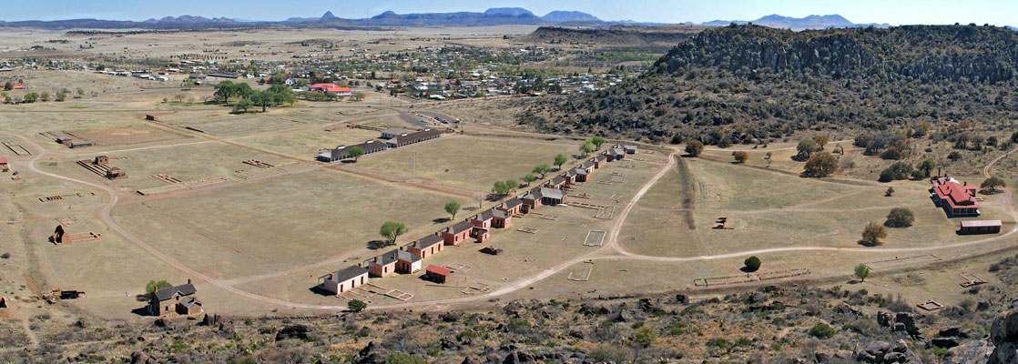
Photographs
Surroundings
Guadalupe Mountains National Park
Guadalupe Peak
McKittrick Canyon
Photographs
Surroundings
Lake Meredith National Recreation Area
Photographs
Langtry
Photographs
Lost Maples State Natural Area
Photographs
Padre Island National Seashore
Map
Photographs
QTVR Panorama
Weather and Climate
Palmetto State Park
Palo Duro Canyon
Photographs
The Lighthouse Trail
Surroundings
Pedernales Falls State Park
Surroundings
Photographs
San Antonio Missions National Historical Park
The Missions
Photographs
Arizona
|
California
|
Colorado
|
Nevada
|
New Mexico
|
Texas
|
Utah
|
Wyoming
|
Slot Canyons
|
Travelogue
|
SOUTHWEST