OREGON


Map of Crater Lake National Park


Sites in Oregon

NPS
Crater Lake
John Day Fossil Beds

Other Places
Cape Arago SP
Cape Sebastian SP
Coquille Point
Crook Point
Floras Lake SP
Harris Beach SP
Newberry Volcanic
Oregon Dunes
Port Orford Heads
Samuel Boardman SSC
Shore Acres SP
South Pacific Coast
Southeast Oregon
Sunset Bay SP

Follow americansouthwest.net on Facebook
Site Search

Photograph Search


Crater Lake National Park > Map

Map of Crater Lake National Park

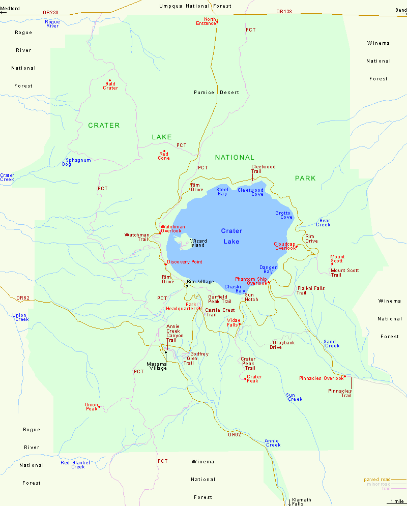
Three main roads lead to Crater Lake National Park: Hwy 62 from Klamath Falls (57 miles), Hwy 62 from Medford (76 miles) and Hwy 138 which links with US 97 from Bend (108 miles) - distances from Rim Village

Trail descriptions for Crater Lake National Park

Back to Top

All Contents © Copyright John Crossley | Comments and Questions | Site Map

Arizona California Colorado Nevada New Mexico Oregon Texas Utah Wyoming Slot Canyons Travelogue