Home
|
Parks
|
Trails
|
Plants
|
Canyons
Maps
|
Landscapes
|
Site Map
|
Whats New?
|
More...
×
General Pages
Home
Parks
Trails
Plants
Slot Canyons
Maps
Landscapes
Itineraries
Site Map
What's New?
More pages...
States
Arizona
California
Colorado
Idaho
Nevada
New Mexico
Oregon
Texas
Utah
Wyoming
MENU
ARIZONA
CALIFORNIA
COLORADO
IDAHO
NEVADA
NEW MEXICO
OREGON
TEXAS
UTAH
WYOMING
NEW MEXICO
MAPS
|
PARKS
|
TRAILS
|
HOTELS
All New Mexico Locations...
NPS
Aztec Ruins
Bandelier
Capulin Volcano
Carlsbad Caverns
Chaco Culture
El Malpais
El Morro
Gila Cliff Dwellings
Petroglyph
Salinas Missions
White Sands
OTHER PLACES
Aguirre Spring
Ah-Shi-Sle-Pah
Angel Peak
Bisti Wilderness
Bluewater Lake State Park
Bosque del Apache
Bottomless Lakes
Burnham Badlands
Ceja Pelon
Cimarron Canyon
City of Rocks
Crow Canyon Petroglyphs
De-Na-Zin
Elephant Butte Lake
Fossil Forest
Jemez Historic Site
Jemez Mountains
Kasha-Katuwe
Living Desert Zoo and Gardens
Lybrook Badlands
Navajo Lake
Ojito
Oliver Lee Memorial
Penistaja Mesa
Rock Hound
Route 66
San Jose Badlands
San Juan Basin
Santa Fe
Santa Fe to Roswell
Shiprock
Valley of Fires
Wild Rivers
New Mexico site map
Photographs of the Ojito Wilderness Area
New Mexico
>
Ojito Wilderness Area
> Photographs
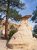
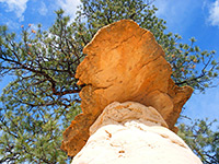
Hoodoo and pine tree
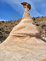
Sandstone pillar
Slender hoodoo
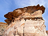
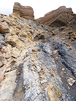
Protruding strata
Wide caprock
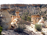
Hoodoo garden
Teepee-like mounds
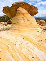
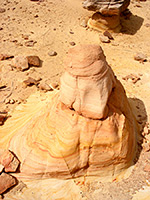
Mushroom rock
Pinkish intrusions
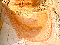
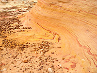
Wave formation
Eroded pinnacle
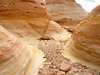
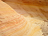
Patterns in the sandstone
Sandstone balls
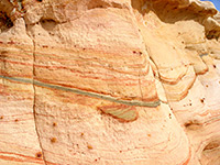
Thin strata
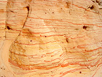
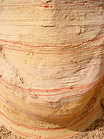
Curvy pink lines
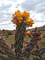
Cholla cactus fruit
Upturned strata
Jumbled rocks
Grey and yellow rocks
Strata in the anticline
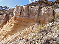
White sandstone
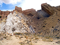
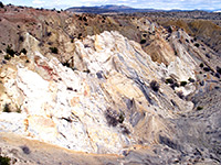
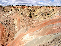
Badlands
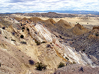
Jagged ridges
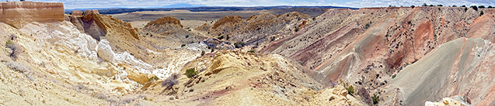
San Ysidro anticline
Related Photographs:
Badlands
-
Cholla
-
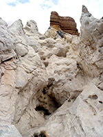
Hoodoos
Back to Top
All Contents © Copyright The American Southwest
|
Comments and Questions
|
Contribute
|
Affiliate Marketing Disclosure
|
Site Map