NEW MEXICO


Map of El Malpais National Monument


Sites in New Mexico

NPS Units
Aztec Ruins
Bandelier
Capulin Volcano
Carlsbad Caverns
Chaco Culture
El Malpais
El Morro
Gila Cliff Dwellings
Petroglyph
Salinas Missions
White Sands

Other Places
Aguirre Spring
Ah-Shi-Sle-Pah
Angel Peak
Bisti Wilderness
Bosque del Apache
Bottomless Lakes
Cimarron Canyon
City of Rocks
De-Na-Zin
Elephant Butte Lake
Jemez Mountains
Kasha-Katuwe
Living Desert
Navajo Lake
Ojito
Oliver Lee Memorial
Rock Hound
Route 66
San Juan Basin
Santa Fe
Santa Fe to Roswell
Shiprock
Valley of Fires
Wild Rivers

New Mexico Site Map

Follow americansouthwest.net on Facebook
Site Search

Photograph Search


El Malpais National Monument > Map

Map of El Malpais National Monument

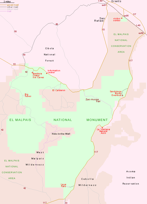
El Malpais National Monument is bounded by two roads - NM 117 along the east edge and NM 53 to the west. Distances of selected locations from Grants include Sandstone Bluffs Overlook (19 miles), La Ventana Natural Arch (25 miles), Lava Falls (37 miles), El Calderon (22 miles) and Big Tubes (37 miles). Apart from interstate 40 in the north, the only other route linking the two sides of the monument is NM 42, a rough, unpaved forest track.

PDFPDF format map of El Malpais National Monument, from the National Park Service.


Back to Top

All Contents © Copyright John Crossley | Comments and Questions | Site Map

Arizona California Colorado Nevada New Mexico Oregon Texas Utah Wyoming Slot Canyons Travelogue