Viewpoints of the Colorado River: Dead Horse Point State Park
Highlights of the West > Colorado River Viewpoints
 | |||
|
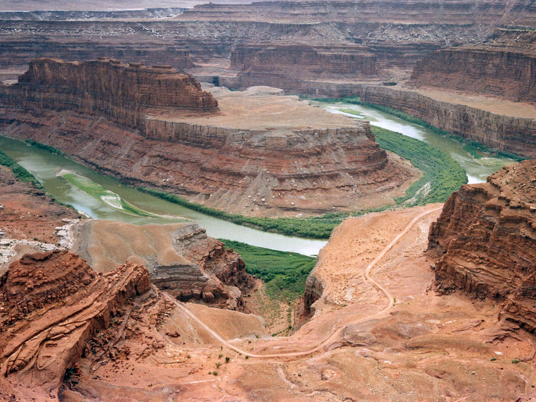
A few miles southwest of Moab, the Colorado River becomes enclosed by high cliffs and ledges, and most viewpoints are from some distance away. One of the closer overlooks, and amongst the finest viewpoints in all Utah, is at Dead Horse Point State Park, just north of a tight bend in the river, where it flows around a promontory known as Goose Neck. The White Rim Road can be seen in the foreground; this is a lengthy unpaved route, for 4WD vehicles only, but beyond the initial section, even this road generally stays several miles from the river, separated from it by branched side canyons. There are not even any trails along this stretch of the river, though the Colorado can be reached by cross-country routes down some of the drainages.
Dead Horse Point State Park - full description
Dead Horse Point State Park - full description

All Contents © Copyright The American Southwest | Comments and Questions | Contribute | Affiliate Marketing Disclosure | Site Map