American Southwest
Home | Categories | National Parks | Hotels | Site Map | Photographs | QTVR | Whats New? | More...
CALIFORNIA
Index | Introduction | Photographs | QTVR | Driving Distances | Map | Weather | Hotels


Map of Yosemite National Park

Sites in California

NPS Units
Cabrillo
Death Valley
Golden Gate
Joshua Tree
Kings Canyon
Lassen Volcanic
Lava Beds
Mojave
Muir Woods
Pinnacles
Point Reyes
Redwood
Sequoia
Yosemite

Other Places
Anza Borrego Desert
Big Basin Redwoods
Big Sur
Bodie SHP
California Missions
Humboldt Redwoods
Lake Tahoe
Palm Springs
Point Lobos

California Site Map

Site Search


Yosemite National Park > Map
Map of Yosemite National Park

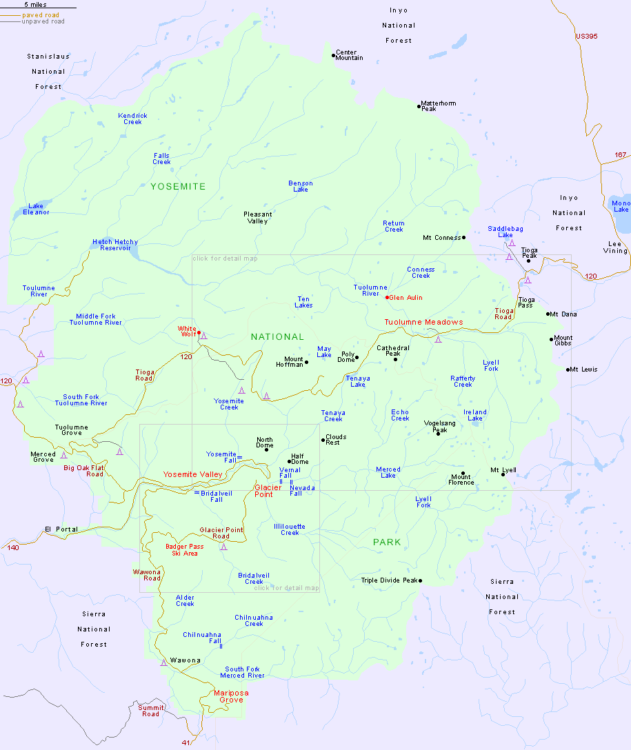
Other Yosemite maps:
East end of Yosemite Valley.
Trails around Yosemite Valley and the Glacier Point Road.
Trails around Tuolumne Meadows and the Tioga Road.

PDF format maps of Yosemite National Park, from the National Park Service:

PDF National park map (1.6 mb)
Yosemite Valley map (196 kb)

Satellite Photo/Map: View above Yosemite National Park:

Back to Top

All contents © copyright John Crossley | Comments and questions
Arizona California Colorado Nevada New Mexico Texas Utah Wyoming Slot Canyons Travelogue