American Southwest
Home | Categories | National Parks | Hotels | Site Map | Photographs | QTVR | Whats New? | More...
CALIFORNIA
Index | Introduction | Photographs | QTVR | Driving Distances | Map | Weather | Hotels


Map of Devils Postpile National Monument

Sites in California

NPS Units
Cabrillo
Death Valley
Devils Postpile
Golden Gate
Joshua Tree
Kings Canyon
Lassen Volcanic
Lava Beds
Mojave
Muir Woods
Pinnacles
Point Reyes
Redwood
Sequoia
Yosemite

Other Places
Anza Borrego Desert
Big Basin Redwoods
Big Sur
Bodie SHP
California Missions
Humboldt Redwoods
Lake Tahoe
Palm Springs
Point Lobos

California Site Map

Site Search


Devils Postpile National Monument > Map

Map of Devils Postpile National Monument

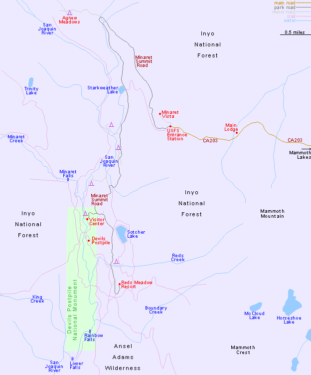
The visitor center in Devils Postpile National Monument is 16 miles from US 395 - 8 miles along Highway 203 through Mammoth Lakes as far as Main Lodge at Mammoth Mountain, then 8 miles in a shuttle bus along the Minaret Summit Road, across land of the Inyo National Forest. Early or late in the season, however, visitors may drive all the way in their own vehicle, as can all people camping or long distance hiking.


PDF format maps of Devils Postpile National Monument, from the National Park Service:
PDFPark map (1.9 mb)
Area map (572 kb)
Map of Mammoth Lakes
Back to Top

All contents © copyright John Crossley | Comments and questions
Arizona California Colorado Nevada New Mexico Texas Utah Wyoming Slot Canyons Travelogue